Weather Under The Radar The Real Story
Skywarn The Weather channel feeds
Skywarn is an organization consisting of individual tornado spotters. During severe thunderstorm situations, the spotters closely monitor the skies for tornado development. Skywarn members report to their local National Weather Service (NWS) Forecast Office via ham radio or cellular phone if they sight possible funnel cloud formations.
Skywarn organizations generally include members of the local police and fire departments among their ranks, men and women specifically trained to spot tornado activity. Some of these people are also storm chasers.
Supercell Tornadoes
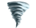
Some of the most violent tornadoes develop from supercell thunderstorms. A supercell thunderstorm is a long-lived thunderstorm possessing within its structure a continuously rotating updraft of air. These storms have the greatest tendency to produce tornadoes, some of the huge wedge shape. The supercell thunderstorm has a low-hanging, rotating layer of cloud known as a “wall cloud.” It looks somewhat like a layer of a layer cake that hangs below the broader cloud base. One side of the wall cloud is often rain-free, while the other is neighbored by dense shafts of rain. The rotating updraft of the supercell is seen on radar as a “mesocyclone.”
The tornadoes that accompany supercell thunderstorms are more likely to remain in contact with the ground for long periods of time -- an hour or more -- than other tornadoes, and are more likely to be violent, with winds exceeding 200 mph.
Skywarn The Weather channel feeds
Skywarn is an organization consisting of individual tornado spotters. During severe thunderstorm situations, the spotters closely monitor the skies for tornado development. Skywarn members report to their local National Weather Service (NWS) Forecast Office via ham radio or cellular phone if they sight possible funnel cloud formations.
Skywarn organizations generally include members of the local police and fire departments among their ranks, men and women specifically trained to spot tornado activity. Some of these people are also storm chasers.
Supercell Tornadoes
Some of the most violent tornadoes develop from supercell thunderstorms. A supercell thunderstorm is a long-lived thunderstorm possessing within its structure a continuously rotating updraft of air. These storms have the greatest tendency to produce tornadoes, some of the huge wedge shape. The supercell thunderstorm has a low-hanging, rotating layer of cloud known as a “wall cloud.” It looks somewhat like a layer of a layer cake that hangs below the broader cloud base. One side of the wall cloud is often rain-free, while the other is neighbored by dense shafts of rain. The rotating updraft of the supercell is seen on radar as a “mesocyclone.”
The tornadoes that accompany supercell thunderstorms are more likely to remain in contact with the ground for long periods of time -- an hour or more -- than other tornadoes, and are more likely to be violent, with winds exceeding 200 mph.